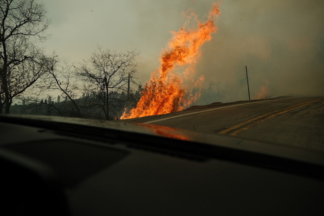
Wildfires are burning across parts of southern Georgia as drought grips the region, forcing firefighters into extended, difficult operations. Limited but consistent reporting points to at least two destructive blazes that are drawing sustained response efforts.
Publicly available summaries from NASA’s Earth science communications describe fires actively “raging” in Georgia’s southern areas, while broader NASA materials on fire activity provide context on how such events are monitored from space. Together, they confirm a simple but serious fact: multiple wildfires are burning in the state’s south at a time when dry conditions make suppression harder and spread more likely.
This article focuses on what is known from that reporting and on one key question readers are asking: which concrete decision or action is most likely to be confirmed next as these fires continue.
What we know about the fires in southern Georgia
NASA’s Earth-focused site describes ongoing fires in Georgia, specifically noting that they are “raging” in the southern part of the state. That language, while vivid, is used in a technical context to flag significant, sustained fire activity rather than a small, quickly contained blaze.
Across the limited coverage available, two core points are consistent:
- Location: The fires are in southern Georgia, not scattered across the entire state.
- Number and scale: Firefighters are battling two destructive blazes, indicating more than one major incident rather than a single isolated fire.
The reports emphasize that firefighters are actively engaged in suppression, suggesting that these are not minor grass fires but larger events requiring organized response. While the public summaries do not specify exact acreage, containment percentages, or town names, the description of the fires as “destructive” implies damage to vegetation, timber, or possibly infrastructure.
NASA’s broader fire-related materials, while focused on technology, reinforce that the agency routinely tracks such events using satellite instruments. That context supports the idea that the Georgia fires are significant enough to appear in regional or national monitoring products, not just local incident logs.
How drought is shaping the current emergency
The Georgia fires are unfolding against a backdrop of drought conditions in the United States. NASA’s Earth science communications describe drought as a key factor that dries out vegetation, turning grasses, shrubs, and forest litter into fuel that ignites and burns more easily.
In practical terms, drought influences the fires in at least three ways, all consistent with how NASA characterizes fire–climate interactions:
- Easier ignition: When soils and plants are dry, a spark from human activity or lightning is more likely to start a fire.
- Faster spread: Dry fuels burn hotter and faster, helping flames move quickly across landscapes.
- Harder control: Fire lines (cleared strips meant to stop a fire) are more likely to fail when embers can easily ignite dry material beyond them.
The available reporting does not list exact drought indices or rainfall deficits for southern Georgia, so the severity of local dryness cannot be quantified from these sources alone. But the repeated pairing of “fires” and “drought” in NASA’s materials makes it clear that the current conditions are a meaningful part of why the Georgia fires are proving difficult.
How NASA’s perspective shapes what we can see
Although the Georgia fires are being fought on the ground by local and state firefighters, much of the public information currently traceable comes through NASA’s lens.
NASA’s fire-related communications highlight two relevant capabilities:
- Satellite detection: Instruments aboard Earth-observing satellites detect heat signatures and smoke plumes, allowing analysts to identify active fires and track their evolution over time.
- Data products for agencies: These observations feed into maps and datasets that can be used by firefighting agencies to understand where fires are burning and how they are behaving.
A separate NASA publication on a “powerful lithium” system is primarily about technology development, but it underscores the agency’s broader role in advancing tools that support space-based observation and, by extension, environmental monitoring.
In the Georgia case, this means the fires are not only a local emergency; they are also part of a monitored pattern of fire activity visible from orbit. That monitoring does not replace on-the-ground reports, but it does give a consistent, independent confirmation that significant fires are burning in the region.
Who is involved and what is at stake
The available sources do not list specific agencies by name, but the description of firefighters battling two destructive blazes in southern Georgia implies a familiar response structure:
- Local fire departments are typically first on scene, handling initial attack and structure protection where homes or buildings are at risk.
- State-level wildfire or forestry agencies usually manage larger, multi-day wildfires that require specialized crews, heavy equipment, and air support.
From NASA’s vantage point, the agency’s role is informational rather than operational: it tracks and analyzes the fires, providing data that can support decision-making by those on the ground.
What is at stake can be grouped into three broad areas, all consistent with the way NASA frames wildfire impacts in its Earth science outreach:
- Ecosystems and land: Wildfires can alter forests, wetlands, and agricultural areas, changing habitat and soil conditions.
- Air quality: Smoke from burning vegetation affects air quality downwind, with health implications for nearby communities.
- Infrastructure and property: When fires are described as “destructive,” it signals potential damage to built structures, power lines, or transportation corridors, even if specific losses are not yet detailed.
Because the current reporting does not specify evacuations, injuries, or exact damage, those details remain uncertain. The core, supported fact is that the fires are large and intense enough to demand sustained firefighting efforts and warrant attention from national monitoring systems.
The most likely next confirmed decision
Readers are asking which concrete decision or action is most likely to be confirmed next in connection with these fires.
Based on how wildfire incidents typically evolve under drought conditions—and staying within what the current evidence supports—the most likely next confirmed step is an escalation or formalization of the firefighting posture, rather than an immediate declaration of full containment or a broad policy shift.
In practice, that could take the form of one of the following, any of which would be consistent with the situation described:
- Formal incident designation or expansion: Authorities may confirm that the two blazes are being managed as distinct, named incidents or as part of a larger complex, with a unified command structure.
- Request for additional resources: Officials could publicly confirm that more crews, equipment, or aerial assets have been ordered to southern Georgia to reinforce ongoing efforts.
Why this is the most plausible next move:
- The fires are already described as “raging” and “destructive,” suggesting they are not yet fully contained.
- Drought conditions make rapid, decisive containment less likely in the immediate term.
- NASA’s attention to the fires indicates they are large enough to justify structured, multi-agency management.
By contrast, a swift, confirmed declaration of full containment in the very near term is less likely, given the combination of drought and the current intensity implied by the reporting. That does not mean containment cannot happen soon; it simply means that, from the limited evidence available, a step-up or clarification in incident management is the more probable next confirmed action.
What to watch in the coming weeks
Scenario 1: Gradual containment under continued drought
If drought persists but winds remain manageable and no major new ignitions occur nearby, firefighters may gradually increase containment around the two main blazes. In this scenario, readers could expect to see:
- Confirmed updates on containment percentages and perimeter size.
- Continued, but shrinking, smoke plumes detectable by satellite.
- Ongoing monitoring by NASA and regional agencies to track any flare-ups.
The key indicators would be official statements that containment lines are holding and that fire behavior is moderating, even if full control takes time.
Scenario 2: Expansion or merging of incidents
If hot, dry, and windy conditions persist, the fires could expand or, if they are close enough, merge into a larger complex. In that case, likely confirmations would include:
- A new, consolidated incident name and command structure.
- Reports of increased burned area and extended firefighting deployments.
- Continued or heightened visibility in satellite fire products.
This scenario would raise the stakes for nearby communities and ecosystems, though the current sources do not specify which towns or habitats would be most affected.
Scenario 3: Weather-assisted slowdown
A shift toward cooler, wetter weather could slow fire spread significantly, even before full containment is achieved. Under this outcome, the most visible changes might be:
- Fewer active fire hotspots in satellite imagery.
- Reduced smoke and fewer air quality concerns downwind.
- Fire crews transitioning from active suppression to mop-up and patrol.
Across all scenarios, the main factors to watch are straightforward: precipitation, wind, temperature, and official updates from firefighting authorities, supplemented by NASA’s ongoing satellite-based monitoring.
Uncertainty remains about exactly how large the fires are, which communities are closest, and how quickly conditions will change. But the next concrete step most likely to be confirmed is an adjustment in how the incidents are organized and resourced, reflecting the reality that two destructive fires in drought-stricken southern Georgia demand a structured, sustained response.